Hi,
You are using the shape map with point data, latitude and longitude create a point on the map. Consider a shape as many points, combined into a polygon, so you would need a shape file.
Please check this response, that I sent to another member in this respect.
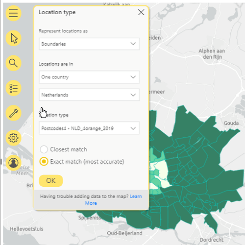
You probably do not need a shape file though, try the Arcgis map visual, under the settings, Layers, you can change the representation to boundaries, postcode.
see image.
Trust this helps.
(You can get different colors for points on your map, it is not straight forward, and as it happens I am in the process of creating content for the new Geospatial section for the website. I have an example how to do this, so this will become available later.)
Paul
